> ## Documentation Index
> Fetch the complete documentation index at: https://docs.assetinfinity.ai/llms.txt
> Use this file to discover all available pages before exploring further.
# GPS trackers and areas
> Registering GPS trackers by IMEI, fitting them to assets, replaying their trips, feeding odometer and engine-hour meters, tracker alerts, and drawing areas that move assets between sites.
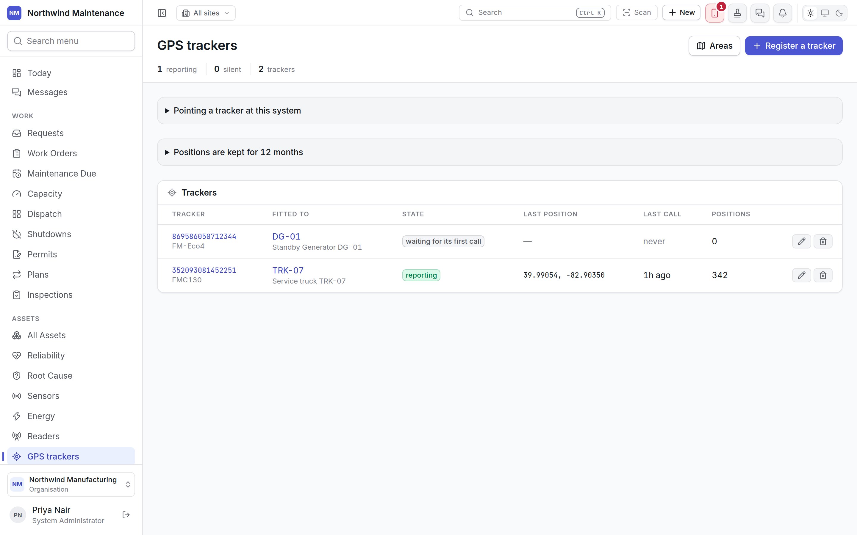
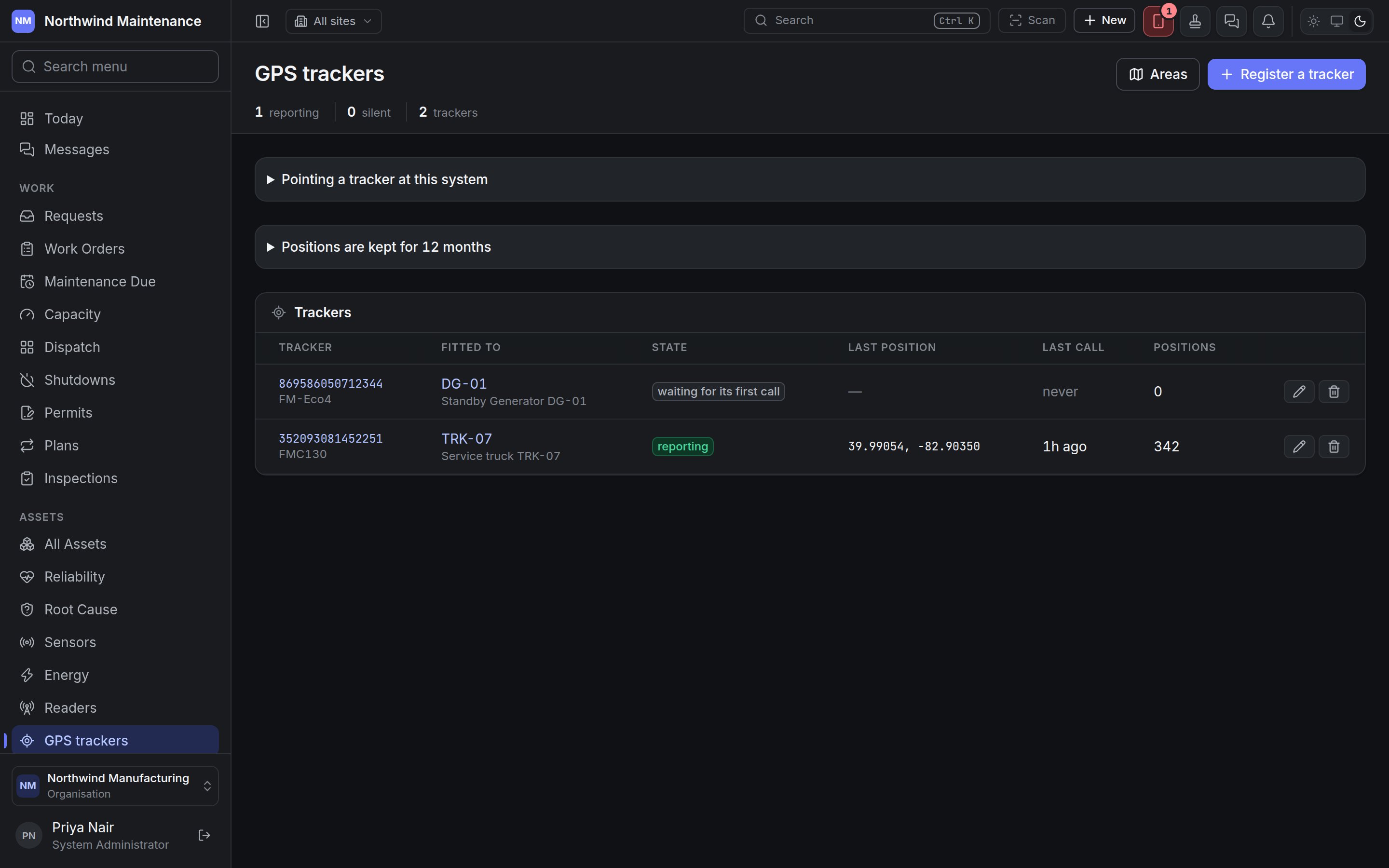
The **GPS trackers** screen lists the vehicle and plant trackers that call in with where they are,
which asset each is fitted to, and whether each is still calling. Open it from **Assets → GPS
trackers**.
If you don't see this in your navigation, your administrator can switch the module on under **Administration → Modules**, or it may not be included in your plan. The module is called **GPS tracking** there.
 A tracker fitted to an asset moves the asset's pin on the map from its next call, and every position
is kept, so where the asset has been can be drawn as well as where it is. Trackers can also feed the
asset's odometer and engine-hour meters, so a plan that falls due every 10,000 km falls due because
the vehicle was driven.
## The header
| Figure | What it counts |
| - | - |
| **reporting** | Trackers calling in normally |
| **silent** | Trackers that have stopped calling for longer than their **Offline after** window |
| **trackers** | Every tracker registered |
**Areas** opens the [areas](#areas) screen. **Register a tracker** adds one.
## Pointing a tracker at this system
A tracker fitted to an asset moves the asset's pin on the map from its next call, and every position
is kept, so where the asset has been can be drawn as well as where it is. Trackers can also feed the
asset's odometer and engine-hour meters, so a plan that falls due every 10,000 km falls due because
the vehicle was driven.
## The header
| Figure | What it counts |
| - | - |
| **reporting** | Trackers calling in normally |
| **silent** | Trackers that have stopped calling for longer than their **Offline after** window |
| **trackers** | Every tracker registered |
**Areas** opens the [areas](#areas) screen. **Register a tracker** adds one.
## Pointing a tracker at this system
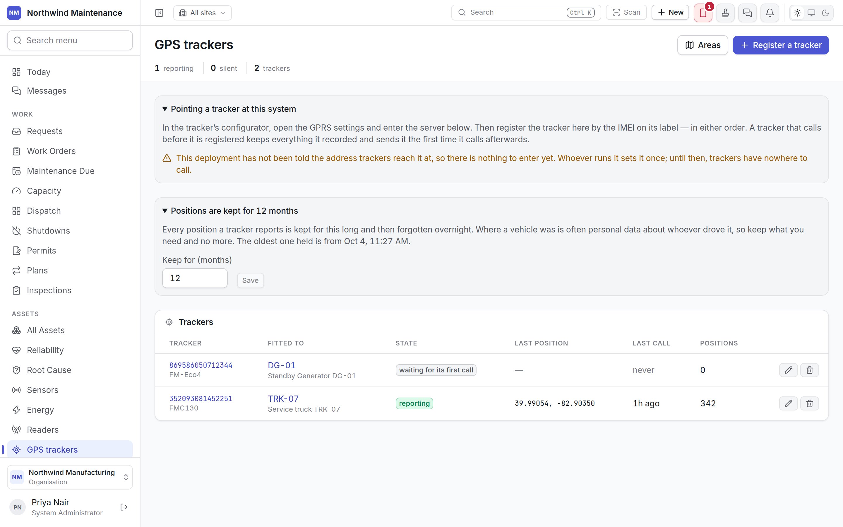
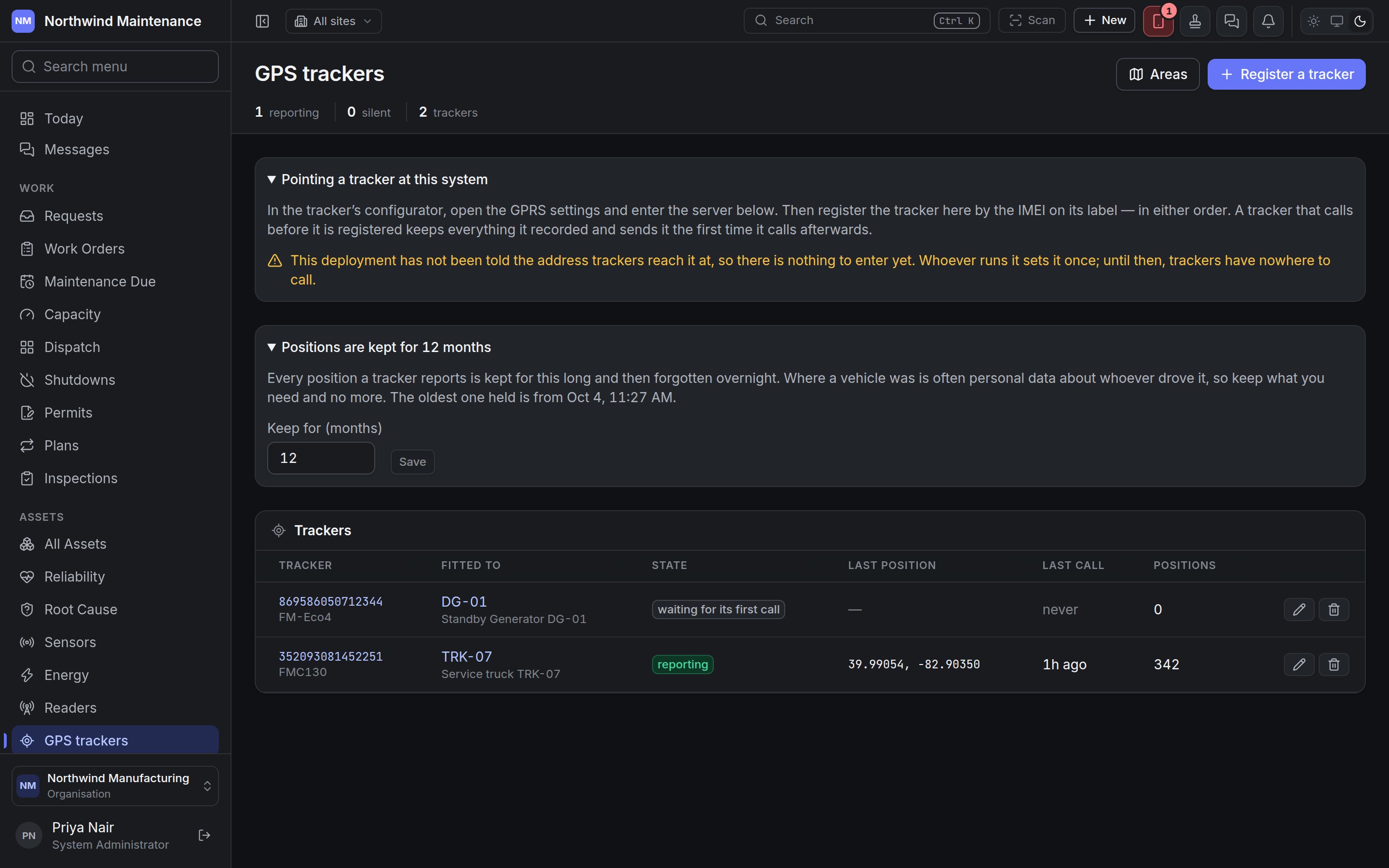 Open **Pointing a tracker at this system** for what to type into the tracker. In the tracker's
configurator, open its GPRS settings and enter the server shown. The table gives each supported
**Family** with its **Domain**, **Port** and **Protocol**. Then register the tracker here by the IMEI
on its label — in either order. A tracker that calls before it is registered keeps what it recorded
and sends it the first time it calls afterwards.
If the tracker will not accept a domain, an IP address is offered with the same port. Use it only
when the domain is refused: a tracker given the domain follows the service if it ever moves, while
one given the number must be reconfigured by hand.
If the panel says this deployment has not been told the address trackers reach it at, there is
nothing to enter yet. Ask your administrator or support contact.
## How long positions are kept
**Positions are kept for … months** sets how long every reported position is kept before it is
forgotten overnight. Where a vehicle was is often personal data about whoever drove it, so keep what
you need and no more. The panel shows the date of the oldest position held. **Keep for (months)**
changes it; shortening it warns that older positions will be forgotten that night and that keeping
them longer again afterwards does not bring them back.
## The tracker list
If any tracker has stopped calling, a **Not calling** section lists those first.
| Column | What it shows |
| - | - |
| **Tracker** | The IMEI, with the model underneath. Click to open it |
| **Fitted to** | The asset, as a link, or *not fitted* |
| **State** | **reporting**, **silent**, **paused** or **waiting for its first call**, plus a warning for **unplugged**, **no power** or **battery low** |
| **Last position** | Latitude and longitude of the last fix, with the speed if it was moving |
| **Last call** | When it last called, or **never** |
| **Positions** | How many positions are held, plus any **waiting on the device** (recorded but not yet sent) and any **thrown away** |
Each row has **Edit tracker** and **Remove tracker** buttons.
### Removing a tracker
**Remove tracker** asks you to confirm. Its trail is kept and the IMEI is freed, so another
organisation can register the device if it is sold on. If it keeps calling, it is treated as a
tracker nobody has registered.
## Registering a tracker
Open **Pointing a tracker at this system** for what to type into the tracker. In the tracker's
configurator, open its GPRS settings and enter the server shown. The table gives each supported
**Family** with its **Domain**, **Port** and **Protocol**. Then register the tracker here by the IMEI
on its label — in either order. A tracker that calls before it is registered keeps what it recorded
and sends it the first time it calls afterwards.
If the tracker will not accept a domain, an IP address is offered with the same port. Use it only
when the domain is refused: a tracker given the domain follows the service if it ever moves, while
one given the number must be reconfigured by hand.
If the panel says this deployment has not been told the address trackers reach it at, there is
nothing to enter yet. Ask your administrator or support contact.
## How long positions are kept
**Positions are kept for … months** sets how long every reported position is kept before it is
forgotten overnight. Where a vehicle was is often personal data about whoever drove it, so keep what
you need and no more. The panel shows the date of the oldest position held. **Keep for (months)**
changes it; shortening it warns that older positions will be forgotten that night and that keeping
them longer again afterwards does not bring them back.
## The tracker list
If any tracker has stopped calling, a **Not calling** section lists those first.
| Column | What it shows |
| - | - |
| **Tracker** | The IMEI, with the model underneath. Click to open it |
| **Fitted to** | The asset, as a link, or *not fitted* |
| **State** | **reporting**, **silent**, **paused** or **waiting for its first call**, plus a warning for **unplugged**, **no power** or **battery low** |
| **Last position** | Latitude and longitude of the last fix, with the speed if it was moving |
| **Last call** | When it last called, or **never** |
| **Positions** | How many positions are held, plus any **waiting on the device** (recorded but not yet sent) and any **thrown away** |
Each row has **Edit tracker** and **Remove tracker** buttons.
### Removing a tracker
**Remove tracker** asks you to confirm. Its trail is kept and the IMEI is freed, so another
organisation can register the device if it is sold on. If it keeps calling, it is treated as a
tracker nobody has registered.
## Registering a tracker
 | Field | What it means | Notes |
| - | - | - |
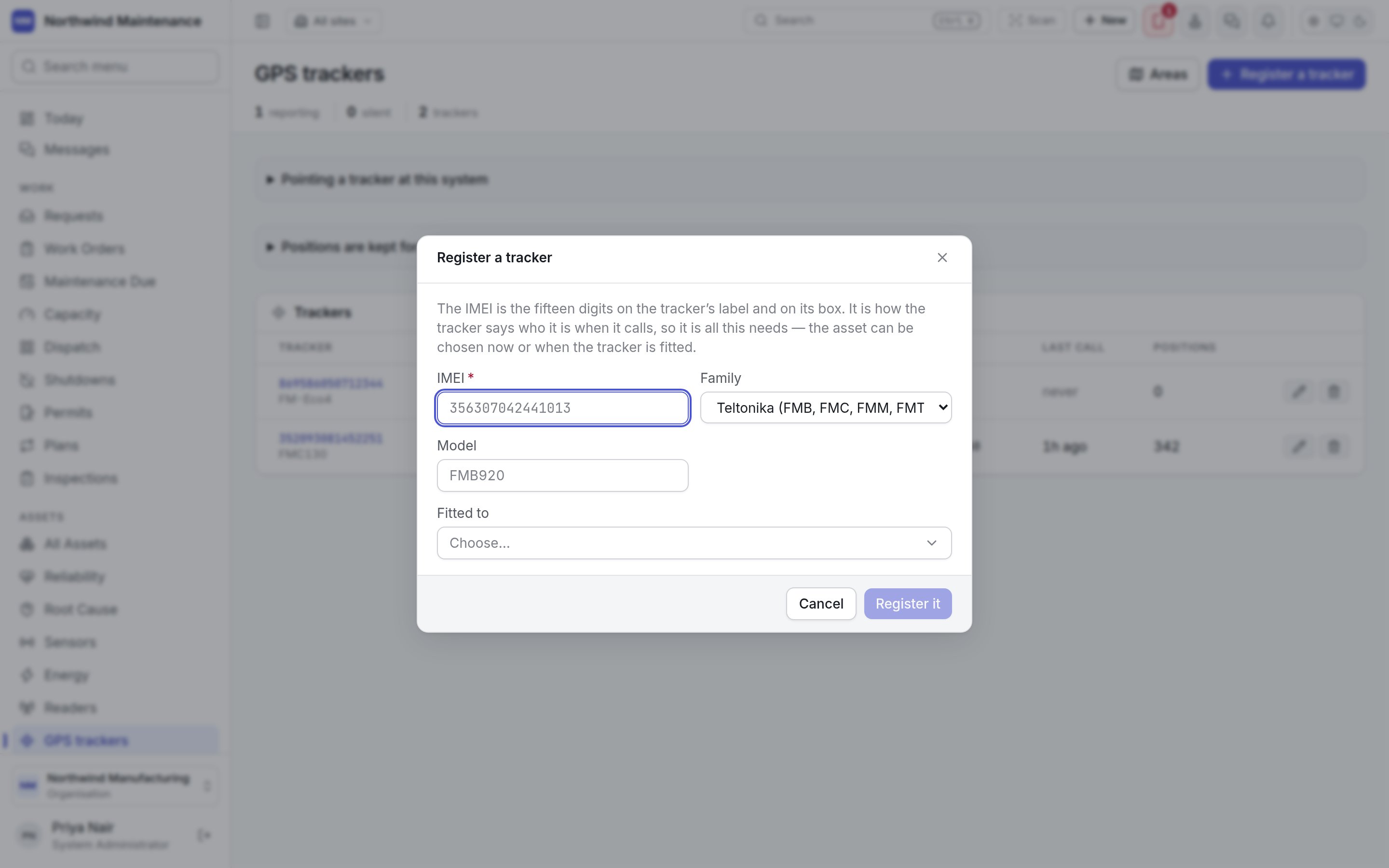
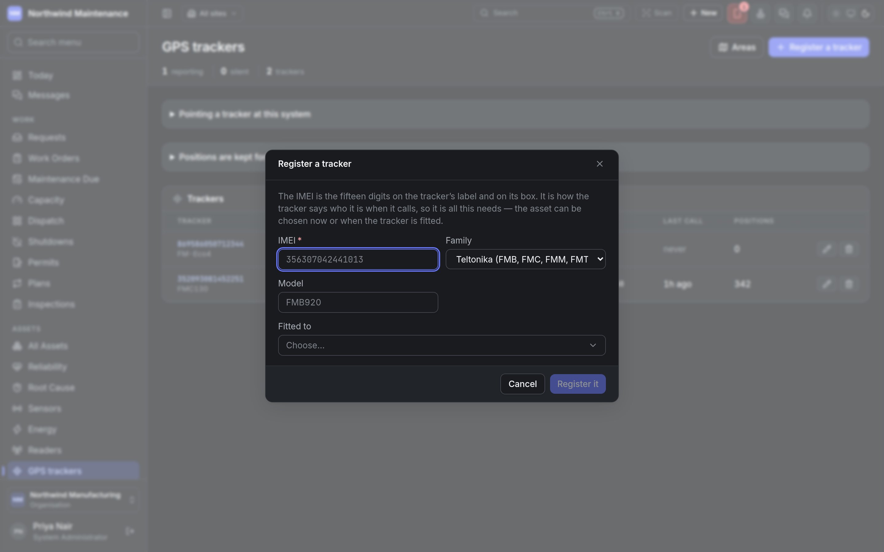
| **IMEI** | The fifteen digits on the tracker's label and box | Required. It is how the tracker identifies itself, and cannot be changed later. For a phone running Traccar Client it is the device identifier set in the app — 8 to 20 digits |
| **Family** | The make of tracker | **Teltonika (FMB, FMC, FMM, FMT)**, **Concox GT06 and compatible**, **Queclink @Track (GV, GL)**, **Ruptela (FM-Eco4, FM-Pro4, Trace5)** or **OsmAnd / Traccar Client (phones)**. It decides the port the tracker calls |
| **Model** | What is written on it, such as FMB920 | Optional, for your reference |
| **Fitted to** | The asset carrying it | Optional. Choose now or when it is fitted |
**Register it** saves it. Registering needs permission to register GPS trackers.
## Editing a tracker
| Field | What it means | Notes |
| - | - | - |
| **IMEI** | The fifteen digits on the tracker's label and box | Required. It is how the tracker identifies itself, and cannot be changed later. For a phone running Traccar Client it is the device identifier set in the app — 8 to 20 digits |
| **Family** | The make of tracker | **Teltonika (FMB, FMC, FMM, FMT)**, **Concox GT06 and compatible**, **Queclink @Track (GV, GL)**, **Ruptela (FM-Eco4, FM-Pro4, Trace5)** or **OsmAnd / Traccar Client (phones)**. It decides the port the tracker calls |
| **Model** | What is written on it, such as FMB920 | Optional, for your reference |
| **Fitted to** | The asset carrying it | Optional. Choose now or when it is fitted |
**Register it** saves it. Registering needs permission to register GPS trackers.
## Editing a tracker
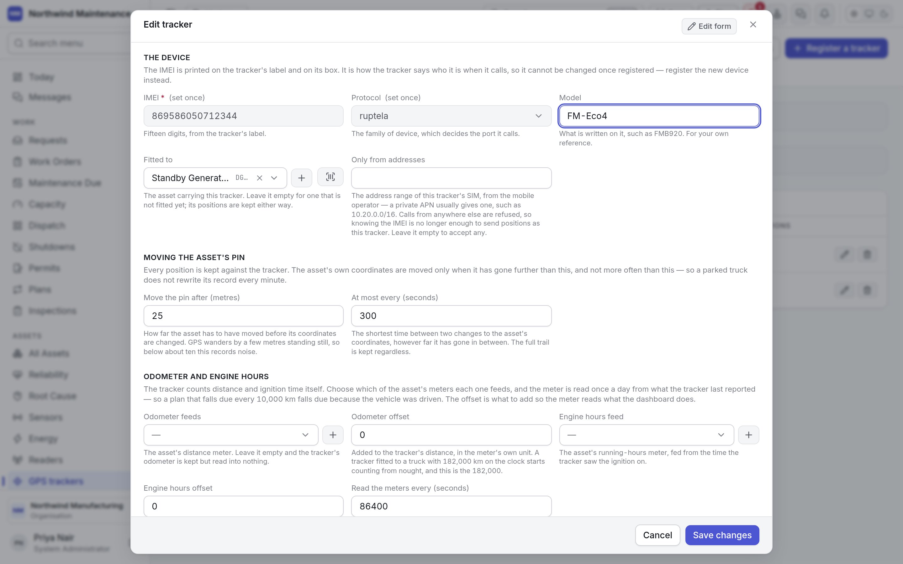
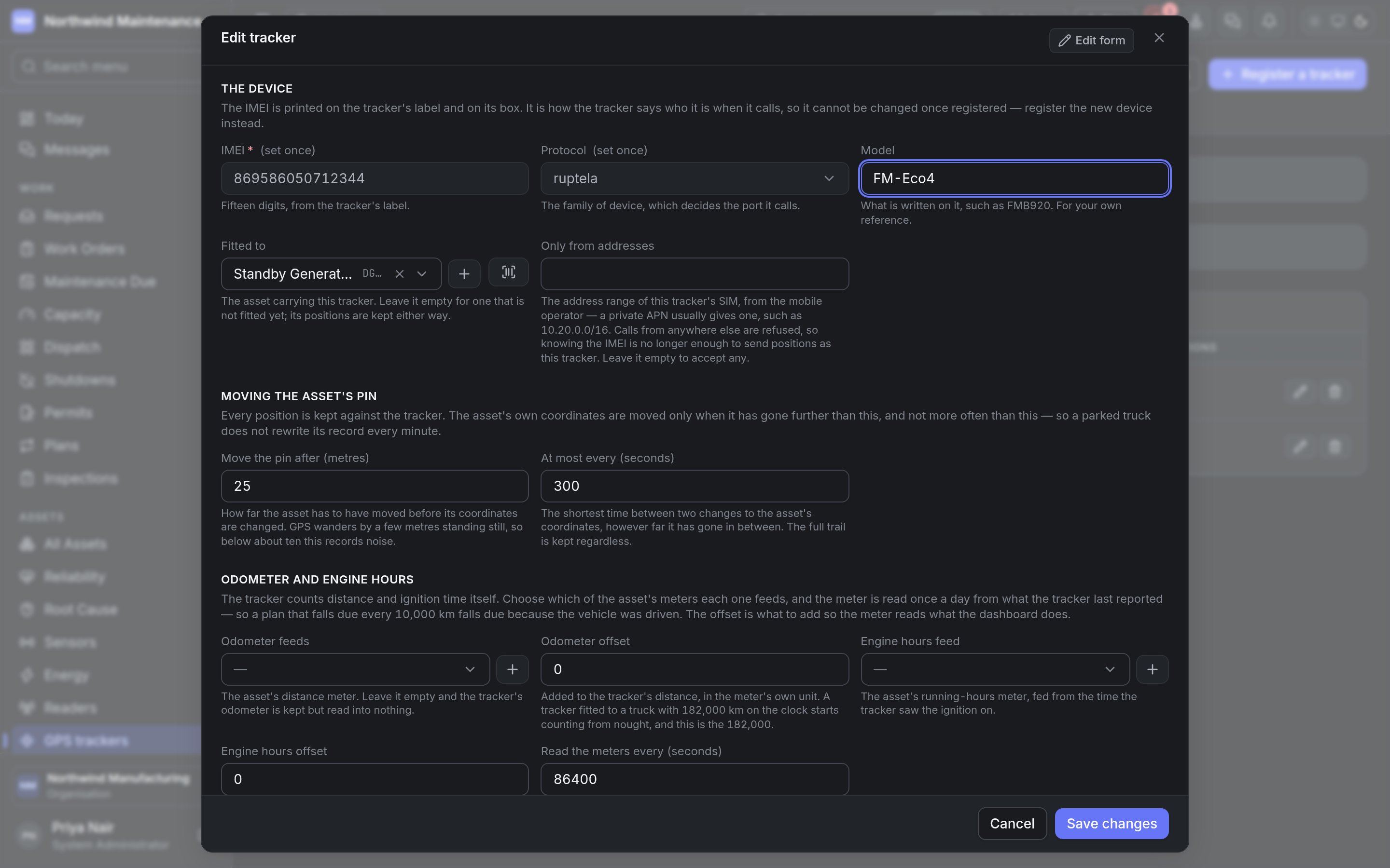 Editing needs permission to fit trackers to assets and configure them.
| Field | What it means | Notes |
| - | - | - |
| **IMEI** | The tracker's identity | Set once. To replace a tracker, register the new device |
| **Protocol** | The family of device | Set once |
| **Model** | What is written on it | Optional |
| **Fitted to** | The asset carrying the tracker | Empty for one not fitted yet; positions are kept either way |
| **Only from addresses** | The address range of the tracker's SIM, such as 10.20.0.0/16 | Optional. Calls from anywhere else are refused, so knowing the IMEI is not enough to send positions as this tracker. Your mobile operator gives you the range with a private APN |
| **Move the pin after (metres)** | How far the asset must move before its coordinates are changed | GPS wanders by a few metres standing still, so below about ten this records noise |
| **At most every (seconds)** | The shortest time between two changes to the asset's coordinates | The full trail is kept regardless |
| **Odometer feeds** | The asset's distance meter | Optional. Empty keeps the tracker's odometer but feeds nothing |
| **Odometer offset** | Added to the tracker's distance, in the meter's unit | A tracker fitted to a truck with 182,000 km on the clock starts from nought; this is the 182,000 |
| **Engine hours feed** | The asset's running-hours meter | Fed from the time the tracker saw the ignition on |
| **Engine hours offset** | Added to the tracker's ignition time, in hours | So the meter reads what the hour counter does |
| **Read the meters every (seconds)** | How often the meters are read from the tracker | Once a day unless there is a reason for more. Each reading is a row in the meter's history |
| **Offline after (minutes)** | How long without a call before the tracker counts as offline and supervisors are told | A parked tracker calls at least hourly, so two hours is two missed calls |
| **Paused** | Stops taking the tracker's positions | It keeps them in its own memory and sends them when resumed, while it has room |
## One tracker
Editing needs permission to fit trackers to assets and configure them.
| Field | What it means | Notes |
| - | - | - |
| **IMEI** | The tracker's identity | Set once. To replace a tracker, register the new device |
| **Protocol** | The family of device | Set once |
| **Model** | What is written on it | Optional |
| **Fitted to** | The asset carrying the tracker | Empty for one not fitted yet; positions are kept either way |
| **Only from addresses** | The address range of the tracker's SIM, such as 10.20.0.0/16 | Optional. Calls from anywhere else are refused, so knowing the IMEI is not enough to send positions as this tracker. Your mobile operator gives you the range with a private APN |
| **Move the pin after (metres)** | How far the asset must move before its coordinates are changed | GPS wanders by a few metres standing still, so below about ten this records noise |
| **At most every (seconds)** | The shortest time between two changes to the asset's coordinates | The full trail is kept regardless |
| **Odometer feeds** | The asset's distance meter | Optional. Empty keeps the tracker's odometer but feeds nothing |
| **Odometer offset** | Added to the tracker's distance, in the meter's unit | A tracker fitted to a truck with 182,000 km on the clock starts from nought; this is the 182,000 |
| **Engine hours feed** | The asset's running-hours meter | Fed from the time the tracker saw the ignition on |
| **Engine hours offset** | Added to the tracker's ignition time, in hours | So the meter reads what the hour counter does |
| **Read the meters every (seconds)** | How often the meters are read from the tracker | Once a day unless there is a reason for more. Each reading is a row in the meter's history |
| **Offline after (minutes)** | How long without a call before the tracker counts as offline and supervisors are told | A parked tracker calls at least hourly, so two hours is two missed calls |
| **Paused** | Stops taking the tracker's positions | It keeps them in its own memory and sends them when resumed, while it has room |
## One tracker
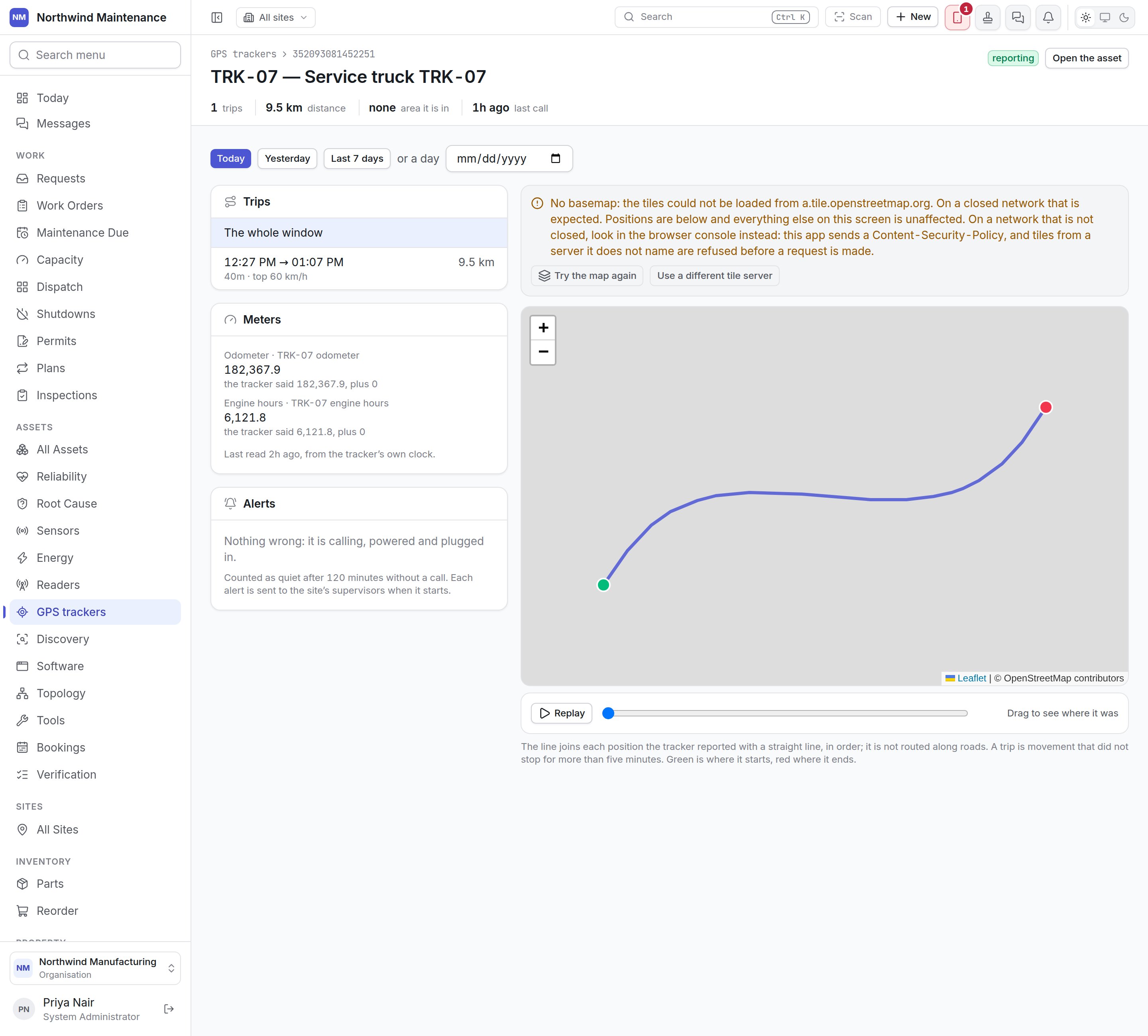
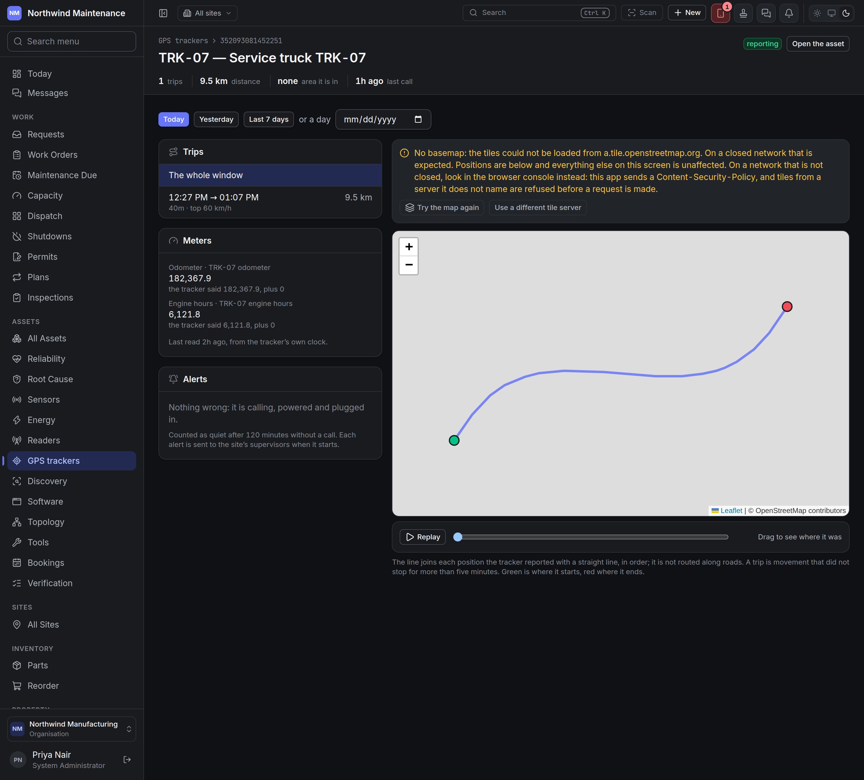 The header shows the tracker's state and the asset it is fitted to, with **Open the asset**, and
counts the **trips** and **distance** in the chosen window, the **area it is in** and its **last
call**.
**Today**, **Yesterday**, **Last 7 days** or a single day (**or a day**) choose the window.
| Section | What it shows |
| - | - |
| **Trips** | Each trip in the window — start and end time, distance, duration and top speed. **The whole window** shows everything. A trip is movement that did not stop for more than five minutes |
| The map | The trail, joining each reported position with a straight line in order — it is not routed along roads. Green marks where it started and red where it ended. **Replay** plays the trail back; drag the slider to see where it was at a given moment |
| **Meters** | The odometer and engine-hour meters it feeds, each with the value written and what the tracker said plus the offset, and when they were last read. If the meters were not moved, it says why |
| **Alerts** | What is wrong now — **Quiet since …**, **Unplugged since …**, **No power from the vehicle since …**, **Backup battery low since …** — and the last SOS. Otherwise *Nothing wrong: it is calling, powered and plugged in* |
Each alert is sent to the site's supervisors when it starts. Silence is noticed by the system after
**Offline after**; the other four are reported by the tracker itself. They can also drive
[automation rules](/config/rules).
The map needs map tiles from a tile server. On a closed network the map shows **No basemap** with
the positions still drawn, and offers **Try the map again** and **Use a different tile server**,
where an administrator can enter your organisation's own tile server for everybody.
## Areas
The header shows the tracker's state and the asset it is fitted to, with **Open the asset**, and
counts the **trips** and **distance** in the chosen window, the **area it is in** and its **last
call**.
**Today**, **Yesterday**, **Last 7 days** or a single day (**or a day**) choose the window.
| Section | What it shows |
| - | - |
| **Trips** | Each trip in the window — start and end time, distance, duration and top speed. **The whole window** shows everything. A trip is movement that did not stop for more than five minutes |
| The map | The trail, joining each reported position with a straight line in order — it is not routed along roads. Green marks where it started and red where it ended. **Replay** plays the trail back; drag the slider to see where it was at a given moment |
| **Meters** | The odometer and engine-hour meters it feeds, each with the value written and what the tracker said plus the offset, and when they were last read. If the meters were not moved, it says why |
| **Alerts** | What is wrong now — **Quiet since …**, **Unplugged since …**, **No power from the vehicle since …**, **Backup battery low since …** — and the last SOS. Otherwise *Nothing wrong: it is calling, powered and plugged in* |
Each alert is sent to the site's supervisors when it starts. Silence is noticed by the system after
**Offline after**; the other four are reported by the tracker itself. They can also drive
[automation rules](/config/rules).
The map needs map tiles from a tile server. On a closed network the map shows **No basemap** with
the positions still drawn, and offers **Try the map again** and **Use a different tile server**,
where an administrator can enter your organisation's own tile server for everybody.
## Areas
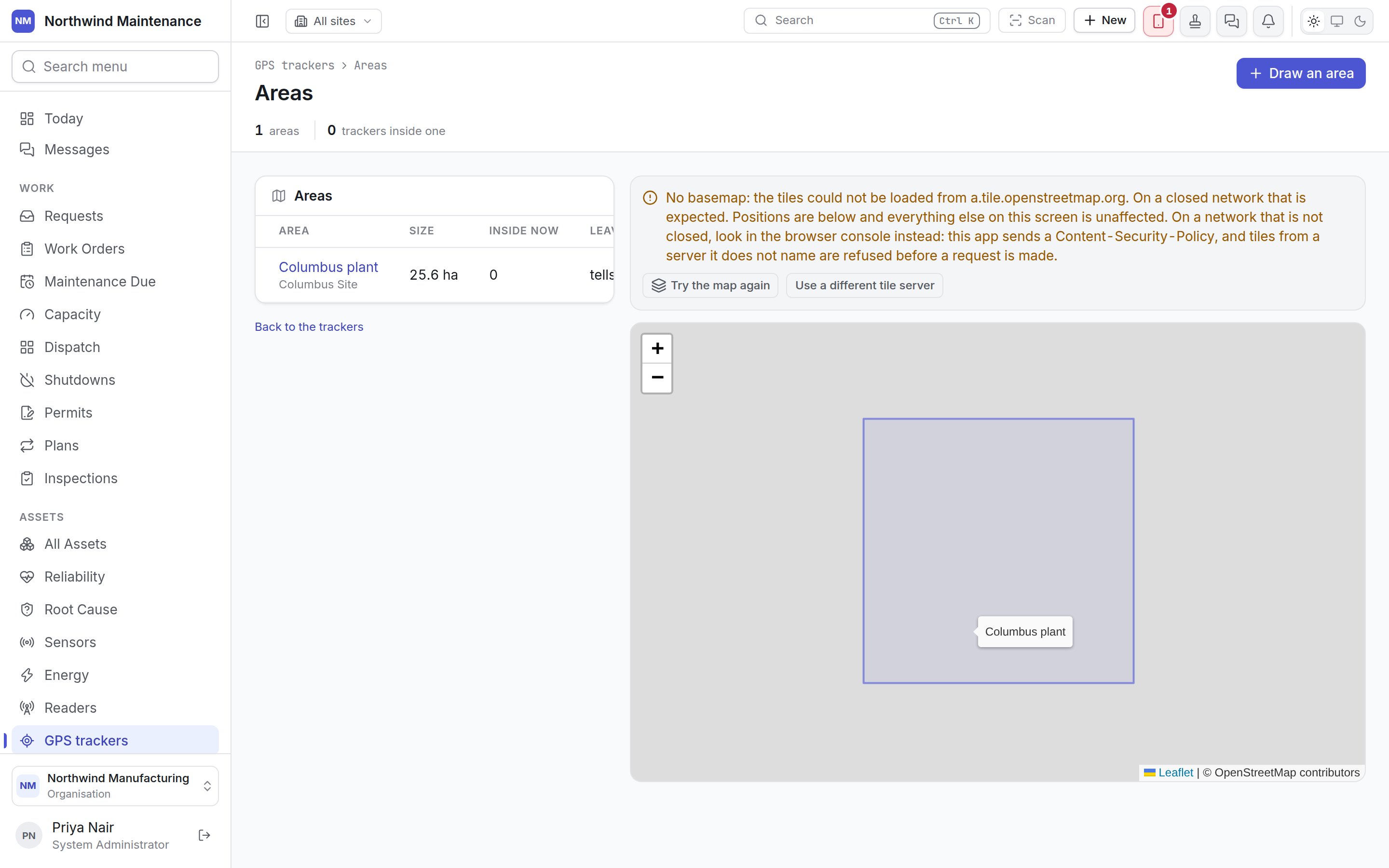
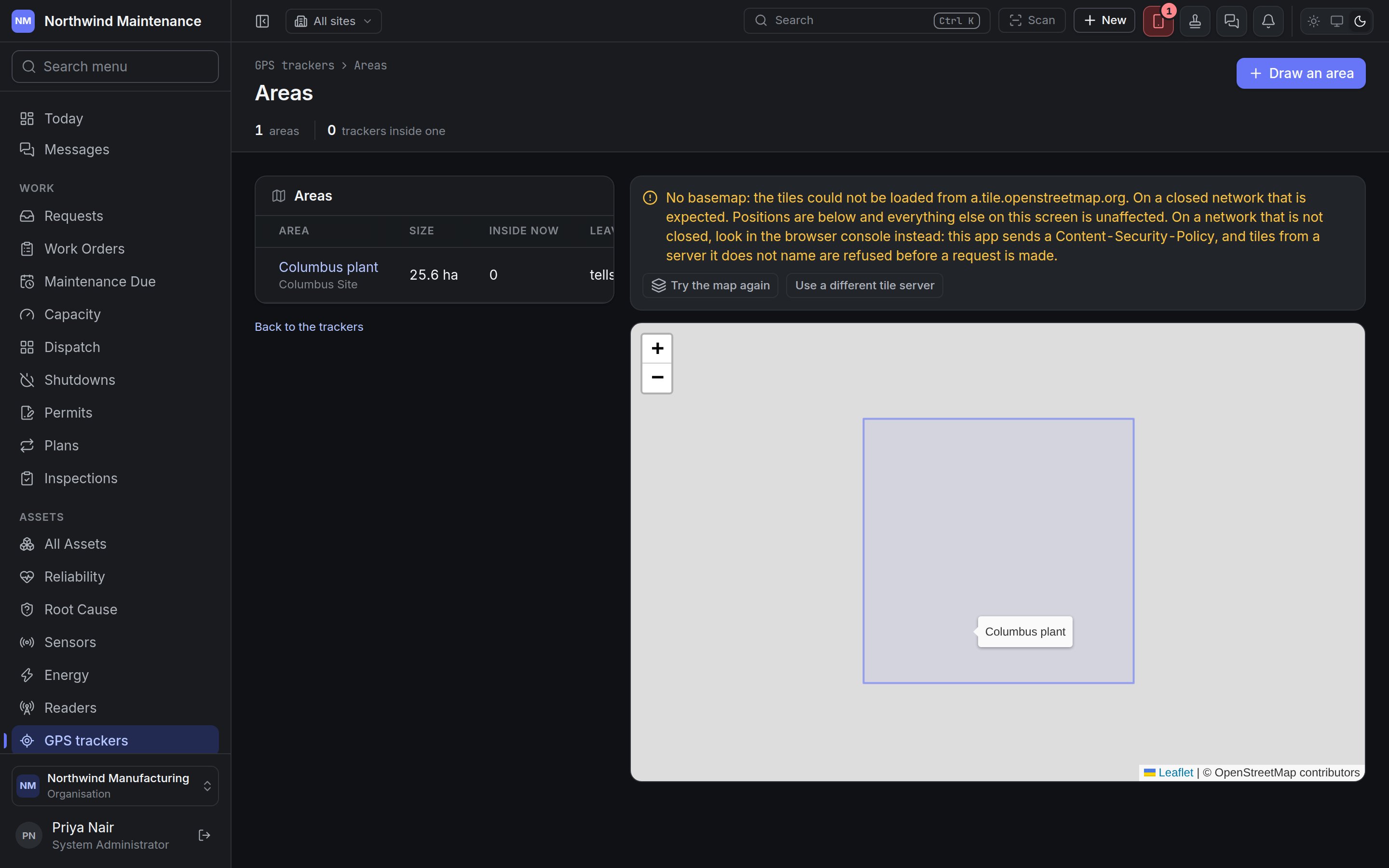 An **area** is the outline of the yard, quarry or depot a site — or one of its locations — occupies.
Open it with **Areas** on the trackers screen.
* A tracked asset whose position falls inside an area is **moved to that site or location**, and the
asset's movement history says when.
* A location's area wins over its site's, so a truck in the workshop yard is in the workshop yard.
* Leaving every area can tell the site's supervisors — the half that matters for plant that should
not leave a site.
The header counts the **areas** and the **trackers inside one**.
| Column | What it shows |
| - | - |
| **Area** | Its name, with the site underneath |
| **Size** | In hectares or square metres |
| **Inside now** | Trackers currently inside |
| **Leaving** | **tells the supervisors**, **says nothing**, or **switched off** for an area not in use |
Each row has **Redraw area** and **Remove area**. Removing an area keeps the movements it caused in each
asset's history; trackers inside it are let go and nothing more is moved because of it.
### Drawing an area
An **area** is the outline of the yard, quarry or depot a site — or one of its locations — occupies.
Open it with **Areas** on the trackers screen.
* A tracked asset whose position falls inside an area is **moved to that site or location**, and the
asset's movement history says when.
* A location's area wins over its site's, so a truck in the workshop yard is in the workshop yard.
* Leaving every area can tell the site's supervisors — the half that matters for plant that should
not leave a site.
The header counts the **areas** and the **trackers inside one**.
| Column | What it shows |
| - | - |
| **Area** | Its name, with the site underneath |
| **Size** | In hectares or square metres |
| **Inside now** | Trackers currently inside |
| **Leaving** | **tells the supervisors**, **says nothing**, or **switched off** for an area not in use |
Each row has **Redraw area** and **Remove area**. Removing an area keeps the movements it caused in each
asset's history; trackers inside it are let go and nothing more is moved because of it.
### Drawing an area
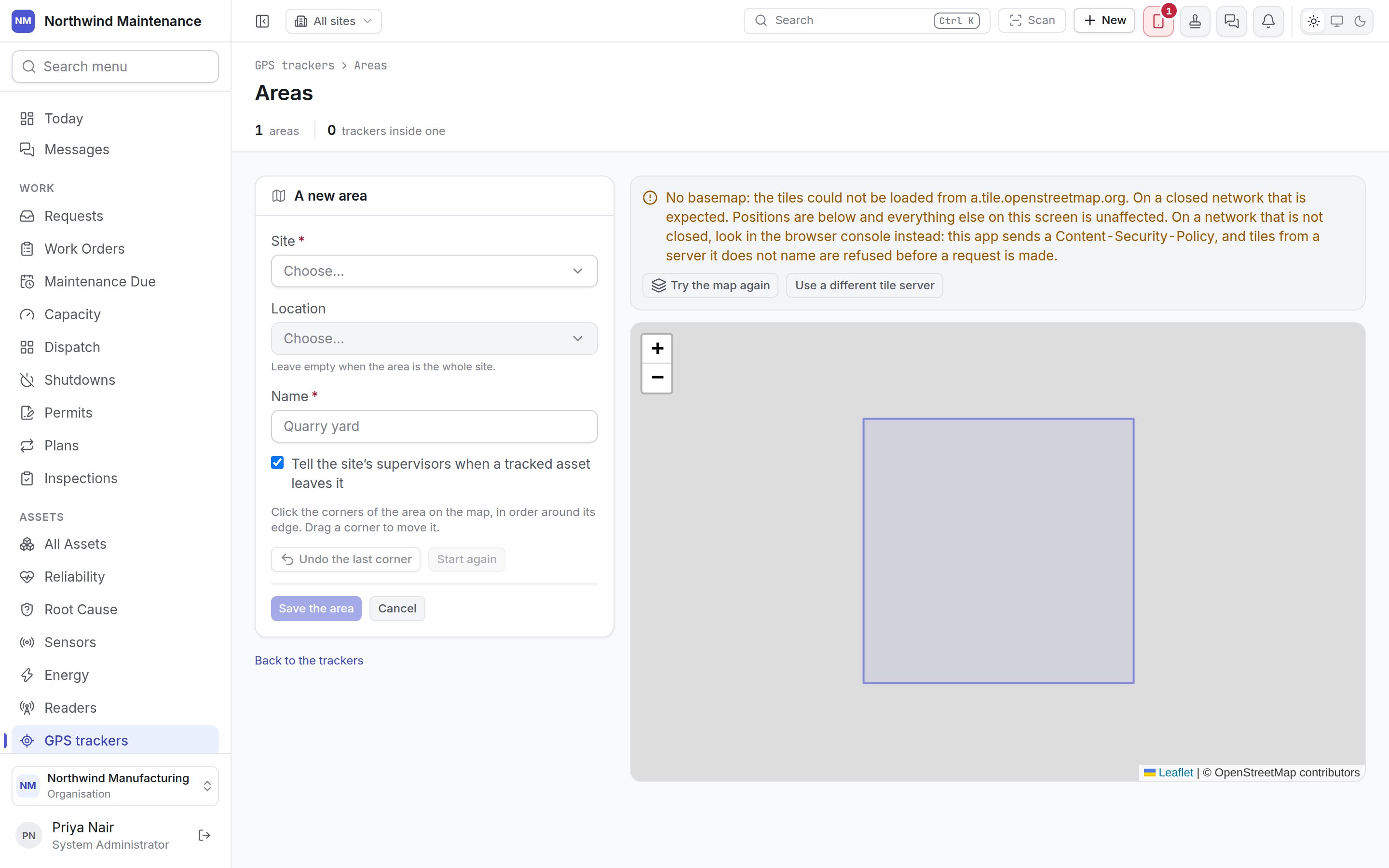
 | Field | What it means | Notes |
| - | - | - |
| **Site** | The site the area belongs to | Required |
| **Location** | The location it is, if not the whole site | Optional |
| **Name** | What to call it — Quarry yard | Required |
| **Tell the site's supervisors when a tracked asset leaves it** | Whether leaving raises a notification | On by default |
| **In use — trackers are checked against it** | Whether the area is active | Shown when redrawing an existing area |
Click the corners of the area on the map in order around its edge; drag a corner to move it. **Undo
the last corner** and **Start again** help, and **Save the area** checks that the outline is closed and
does not cross itself before saving. Drawing and changing areas needs the tracker permissions.
## Who can do what
| To | You need permission to |
| - | - |
| See trackers and their trails | View GPS trackers and where they have been |
| Register trackers and draw areas | Register GPS trackers |
| Fit and configure trackers, redraw areas, change the keeping period | Fit trackers to assets and configure them |
| Remove trackers and areas | Remove GPS trackers |
This documentation is built and hosted on [Mintlify](https://mintlify.com), a developer documentation platform.
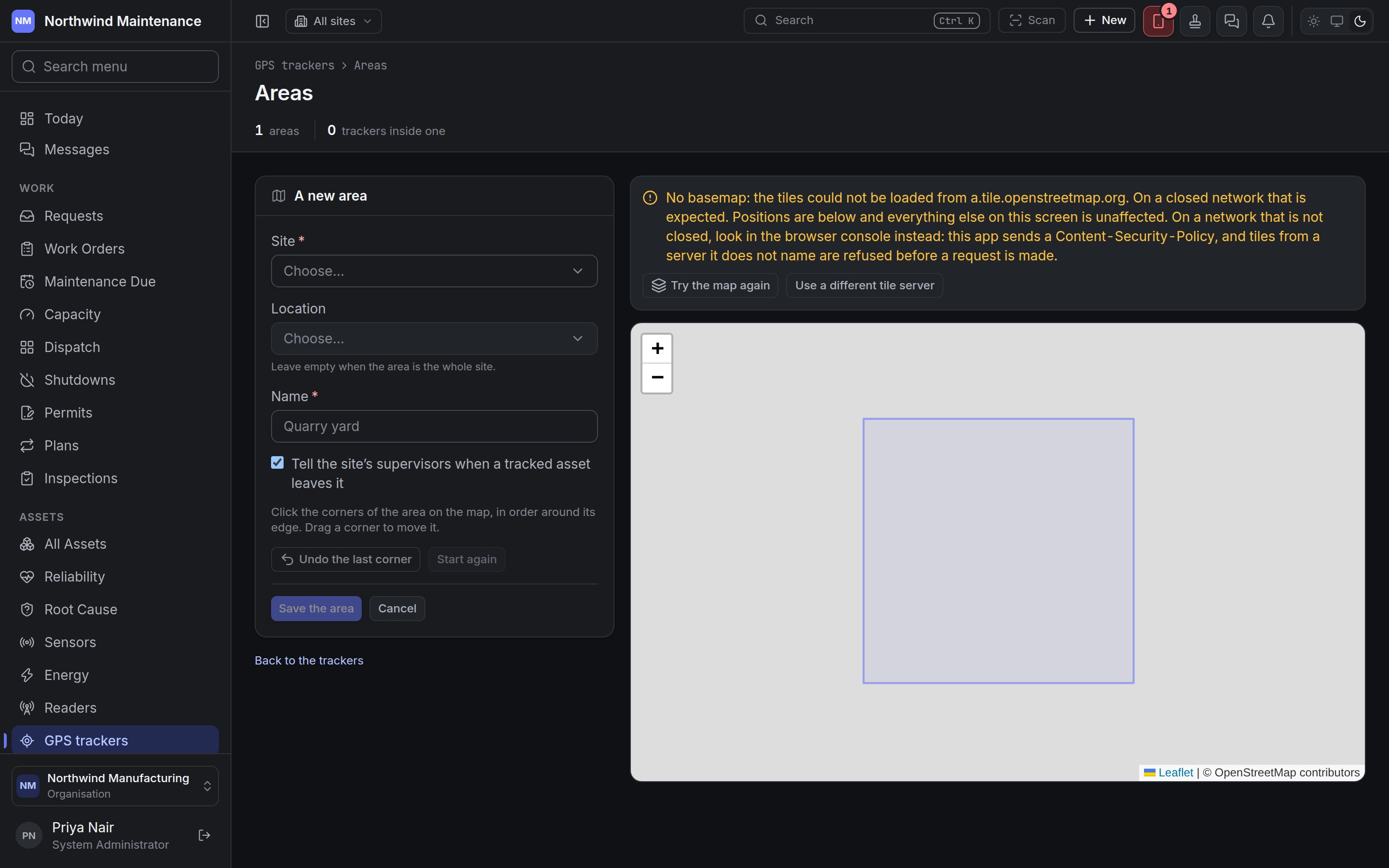
| Field | What it means | Notes |
| - | - | - |
| **Site** | The site the area belongs to | Required |
| **Location** | The location it is, if not the whole site | Optional |
| **Name** | What to call it — Quarry yard | Required |
| **Tell the site's supervisors when a tracked asset leaves it** | Whether leaving raises a notification | On by default |
| **In use — trackers are checked against it** | Whether the area is active | Shown when redrawing an existing area |
Click the corners of the area on the map in order around its edge; drag a corner to move it. **Undo
the last corner** and **Start again** help, and **Save the area** checks that the outline is closed and
does not cross itself before saving. Drawing and changing areas needs the tracker permissions.
## Who can do what
| To | You need permission to |
| - | - |
| See trackers and their trails | View GPS trackers and where they have been |
| Register trackers and draw areas | Register GPS trackers |
| Fit and configure trackers, redraw areas, change the keeping period | Fit trackers to assets and configure them |
| Remove trackers and areas | Remove GPS trackers |
This documentation is built and hosted on [Mintlify](https://mintlify.com), a developer documentation platform.